About Us

Landscape flammability in Landes de Gascogne area

Using paleo-FIRE data to improve our understanding of future landscape flammability in LANDES de Gascogne area: a data-model integration approach.

The global climate is rapidly warming, increasing the likelihood that most terrestrial ecosystems will face new patterns of precipitation and temperature and increasing frequency and severity of extreme weather events. Higher atmospheric water demand from increasing temperature will increase ecosystem flammability, a process that will be exacerbated during increasingly extreme drought events. Initially, the effects of ongoing climate change on wildfire (burned area and ecosystem flammability) were limited to arid locations. However, the fire season of summer 2022 in Southwestern France has demonstrated that areas previously thought to have little chance of burning, such as the Landes de Gascogne area (hereafter LGA), are becoming increasingly flammable, suggesting nonlinear responses to climate change in forest ecosystems. Our understanding of wildfire behaviour (e.g., spread & extent) and its effects has been developed under the narrow, modern-day, range of environmental conditions, creating substantial uncertainty in our forecasts of how climate change will alter wildfire. A more comprehensive understanding of the relationship between area burned and atmospheric warming is required to improve our ability to forecast how climate and wildfire will interact to shape ecosystems and impact society.

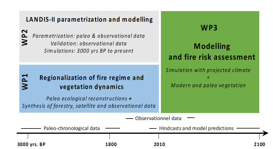
The main objective of FIRE-LANDES project is to improve our ability to project future climate-wildfire interactions in the LGA by leveraging paleo-data and modelling to improve our understanding of how a wider range of past climatic changes altered ecosystem flammability.

LGA

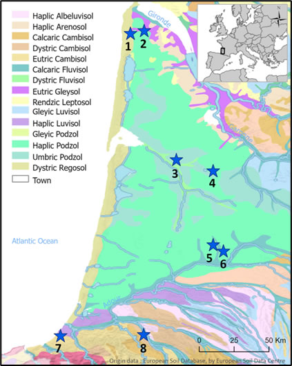
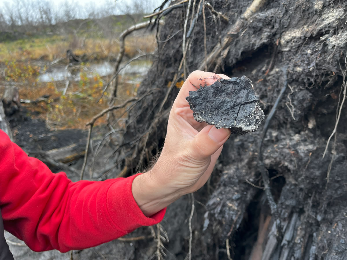
Historically, the LGA also consisted of low-lying wetlands and wet meadows which are now scarce due to intensive maritime pine plantations. These landscape changes have reduced the locations available to sample for palaeoecological investigations. However, we have identified several lake/wetland sites that are distributed throughout the entire region and will allow us to reconstruct the fire and vegetation dynamics over at least the past 3000 years with a suitable temporal resolution (< 100 years/cm). Some of these have already been cored and analysed for pollen at coarse resolution (Fig. 1; Reille, 1993; Diot & Tastet, 1995; Faure & Galop, 2011, Galop personal communication). Here, we will re-sample them notably for paleo-fire reconstruction at higher resolution.

Study Area

The LGA corresponds to a wide triangle shape of 13,000 km2 bordered by the Gironde Estuary to the North, the Garonne River to the East, the Adour River to the South, and the Atlantic Ocean to the West (Fig. 1). This low-lying area is characterised by a flat surface gently inclined towards the ocean. This unique situation along the coast allowed for natural transport of sands far inland, yielding a thin, poorly developed, acidic coversand, usually 1-2 m thick interspaced with sporadic geological outcrops from calcareous, clay and loamy Tertiary (Oligocene and Miocene) deposits. We will sample our paleo-sites in three zones across the LGA region (south, central, north) and simulate 250-500 km2 landscapes around each sampling site (lake/wetland). In each location we seek to sample three lakes/wetland within 50 km of each other. By adopting this approach, we will be able to reconstruct past fire and vegetation histories at both local and regional scales (Ali et al., 2012; Girardin et al., 2013).

Pollen-based vegetation reconstruction, based on previous palynological studies, indicate that prior to 8000 cal. BP (Before present= 1950), the LGA region was dominated by pine (Pinus sylvestris) progressively replaced by mixed and diverse temperate broad-leaved forests, dominated by oak (Quercus sp.) and associated with basswood (Tilia sp.), ash (Fraxinus sp.), hazel (Corylus sp.) and beech (Fagus sylvatica) (see Reille, 1993; Diot & Tastet, 1995; Faure & Galop, 2011). From the end of the Neolithic (after 5000-6000 cal. BP), the LGA region has been intensively shaped by human activities, in particular deforestation during the Middle Ages that has led to an extension of heathlands. According to de Lafontaine et al., (2014), since the Holocene, the LGA has been subject to an uninterrupted period of high fire activity, notably after 5000 cal. BP. We are well aware that during the past, fires could have been linked to human land use. However, we assume that on a multi-century time scale, the synchrony in fire activity between the different zones (south, central and north) should be more related to climate forcing (severe drought conditions) than to human activity. Indeed, large and intense forest fires triggered by climate and/or humans can only occur when conditions are sufficiently dry to make vegetation flammable.

Study area LGA

Figure 1. Study area-LGA. Blue stars, location of available pollen stratigraphies (North: 1-2: Diot & Tastet, 1995; Central: 3-4-5-6: Faure & Galop, 2011; South: 7-Reille, 1993; 8-Galop personal communication).

Work plan

The FIRE-LANDES project is organized in 3 Work Packages (Fig. 2) which are interwoven in the following way:
WP1– will reconstruct the fire and vegetation dynamics of the study area over at least the last 3000 years.
WP2-will parametrize and validate the LANDIS-II model using present and past datasets to simulate the past environment.
• WP3– will simulate the fire risk within of the LGA area in response to ongoing climate change.

work packages fire-landes

Long-term socio-economic impacts and scientific perspectives

The question of the socio-economic impact of this project must be considered on a long-time scale (several decades), since the project aims to document the fire risk of the studied zone during the following decades. Tracing the real economic burden of wildfires is of critical importance to assess the cost-efficiency of wildfire mitigation measures. The economic burden includes direct (e.g. suppression, restoration, property loss, etc.) and indirect (e.g. reduced productivity, reduced ecosystem services, etc.) costs. In this context, our capacity to predict the fire risk is fundamental and a vital issue for communities across the LGA. We will use the validated LANDIS-II model to simulate forest response to climate change and fire regimes for each zone (southern, central, and northern) of the LGA region. Ultimately, we will quantify the effects of climate change and disturbance on a range of ecosystem response variables and identify high fire risk landscapes. These data will pave the way for new fire risk management strategies.

The issue of forest fires is international: where there is fuel, there are wildfires. FIRE-LANDES will place the forest fire management of LGA in a global perspective. The consortium will be able to exchange and discuss the mitigation strategies that will be put in place and even compare them with those developed in the USA and Canada. This exchange of know-how in the context of climate change will undoubtedly make it possible to strengthen collaborations, particularly existing ones, and develop new ones through the respective networks of the different countries.